
Lateral Shifts and Chicanes
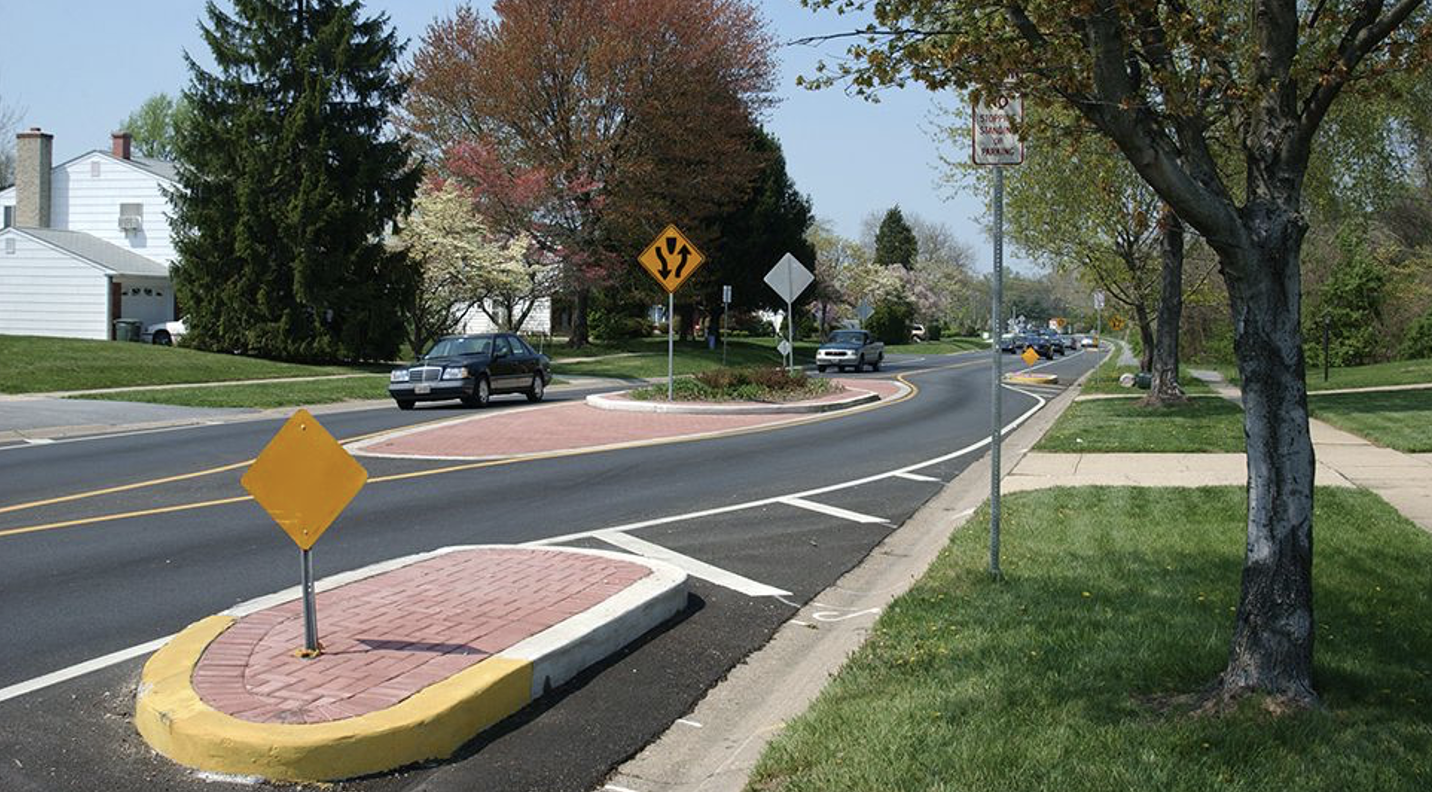
Image Source: NACTO
DEFINITION AND DESCRIPTION
A lateral shift realigns a straight street by shifting traffic in one direction (i.e., to the left or right). Chicanes are a series of alternating lateral shifts that create multiple changes in direction along a roadway segment. Both Lateral Shifts and Chicanes use features such as pavement markings, planting strips, on-street parking, and other features create a sequence of horizontal curves intended to slow vehicle speeds, improve driver attentiveness and reduce crash risk. Curves or shifts can be gentle for modest speed reduction, or more restrictive for greater speed management. Shifts in travel-ways can be created by moving parking from one side of the street to the other (if there is only space for one side of parking), or by building landscaped or hardscaped islands.
Implementation Categories
| Area(s) | Design & Geometrics, HSIP, Operations & Maintenance |
| Safety Category | 2 |

CONSIDERATIONS
- Lateral Shifts and Chicanes encourage motorists to slow down when negotiating curves.
- Landscaped islands can be aesthetically pleasing. Consider an MOA with the local government for long-term maintenance of landscaping.
- Roadway drainage needs should be considered.
- May be difficult for large vehicles to navigate if not designed properly. Should not be used in industrial areas, or routes with significant truck, bus or emergency response activity.
- Using median islands to shift traffic reduces the likelihood a motorist will veer into the path of opposing traffic.
- Mountable curbs should be used on edge and median islands to improve accessibility for larger vehicles.
- Most effective on roadways with posted speed limits ≤ 35 MPH. On higher-speed roads, lateral shifts should be gradual and spread over longer distances.
- If used on multi-lane roadways, consider that vehicles may drift into the adjacent lane; provide adequate width or use channelizing elements.
- Installation could be coordinated with the resurfacing schedule.
- Temporary “quick-build” materials (bollards, striping) may be used to test effectiveness before committing to permanent installation.
- Assess conditions and include accommodations for bicyclists and pedestrians as appropriate. Avoid “pinch points” for bicyclists.
- Include signing and pavement markings (e.g., chevrons, arrows, edge lines) to clearly guide drivers through the alignment.
- Evaluate sight distance through the chicanes to ensure safe operation.
APPLICATION
- Use in speed transition zones (e.g., where roadway context changes), for traffic calming, and on roadways with medium or high levels of pedestrian activity.
- May be appropriate for local, collector, and minor arterial streets requiring traffic calming. Can be implemented on one-way or two-way roadway segments.
- See the Highway Design Manual (HD-700) for lane widths.
- Off-setting parking from side to side of the roadway may be used as an alternative to raised or flush curb extensions. Refer to Chapter 5 of KYTC’s Complete Streets, Roads, and Highways Manual for guidance on parking lane dimensions. Pavement markings shall follow MUTCD Part 3 requirements. A 1-2 ft marked buffer between the parking area and the travel lane is preferred.
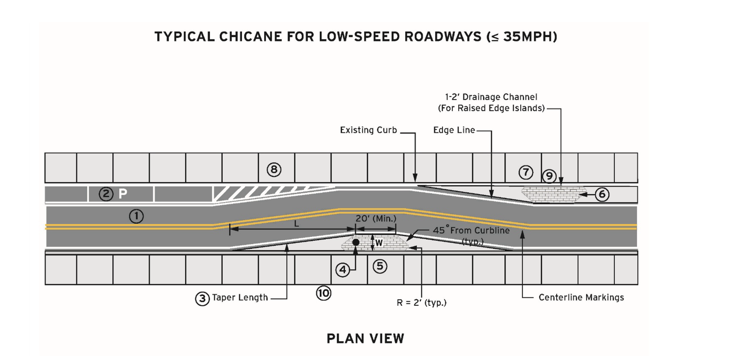
- Shifting of the lane may be done using speed appropriate curvature (see AASHTO Greenbook Table 3-13 Minimum Radii and Superelevation for Low-Speed Streets in Urban Areas) or lane tapers designed for the roadway’s target speed. When lane tapers are used, L = WS²/60, where L is the taper length (ft), W is the lateral offset (ft), and S is the target speed (mph). Traffic calming effects are greatest when lateral offset, W, is at least one full lane width.
- Object markers (Type 2 or Type 3), pavement-mounted flexible tubular markers, or delineators may be included for increased visibility for drivers and snowplow operators.
- Raised islands using mountable curbs are recommended where feasible; otherwise, delineation with pavement markings is acceptable. Refer to Standard Drawing RPM-100 for curb installation details. If pavement markings are used instead of raised islands, incorporate flexible delineators to help guide users and reinforce proper use of the chicane.
- Curb extensions or edge islands are commonly used. In cases where drainage is a concern, edge islands with a 1-2 ft gap from the curb are recommended.
- All signing and striping shall comply with the MUTCD. See Section 3J.04 for Curb Marking for Raised Islands. See Section 2C.72 for Object Markers for Obstructions Adjacent to the Roadway. Wider longitudinal lines – at least twice the width of a normal line – may be used.
- Crosshatch markings should be thermoplastic.
- Raised edge islands should use stamped concrete or other materials that provide visual contrast with the roadway. If landscaping is included, plantings must be kept low enough to avoid obstructing sight distance for approaching traffic, side roads, or entrances.
- Lighting should be considered.
example
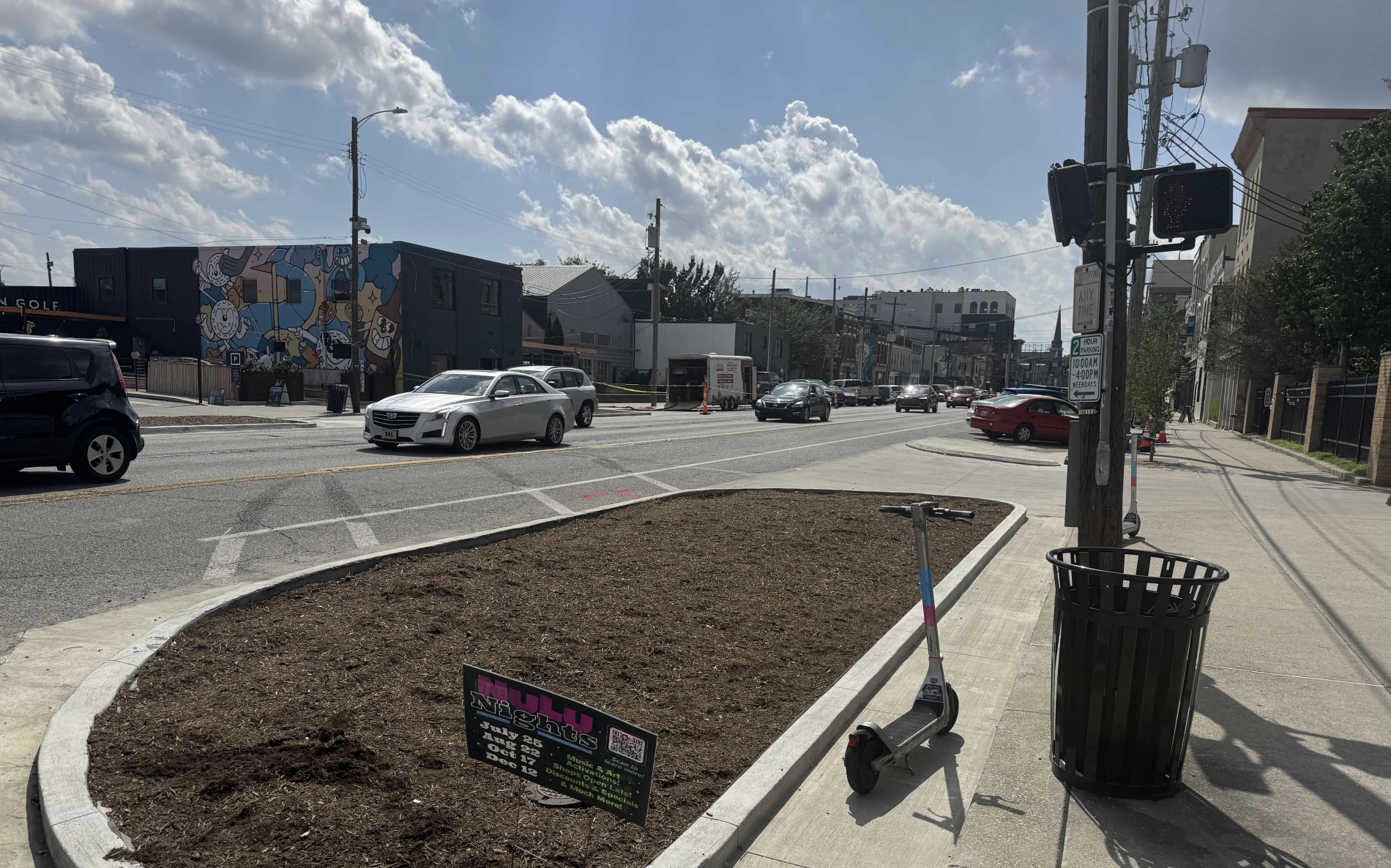
Image Source: KYTC. Edge Island on E. Market St., Louisville
Complementary SSA Strategies
- Roadway Reconfiguration
- Successively Smaller Curves
- Curb Extensions
- Median and Pedestrian Refuge
REFERENCES AND RESOURCES
Urban Street Design Guide. National Association of City Transportation Officials (NACTO). Island Press, 2013. https://nacto.org/publication/urban-street-design-guide/street-design-elements/curb-extensions/chicane/
FHWA, Traffic Calming ePrimer. https://highways.dot.gov/safety/speed-management/traffic-calming-eprimer#eprimer
CONTACT:
Jill Asher
Research Engineer
jill.asher@uky.edu